13 November, 2009: the Poolsite as it is now
Water Lane is to the right, Wharf Lane is to the left, and the service road runs along the top of the site. King Street is the dark area at the very top of the picture. The Embankment is at the bottom. The play area and the temporary cafe only use about a fifth of the site, and the rest is fenced off and derelict. The privately owned car park behind the Santander (formerly Abbey) building society to the right of the poolsite is not part of the projected redevelopment. The buildings to the right of the pool itself are the old café, the caretaker's house now used by the HANDS charity, and the former toilets.
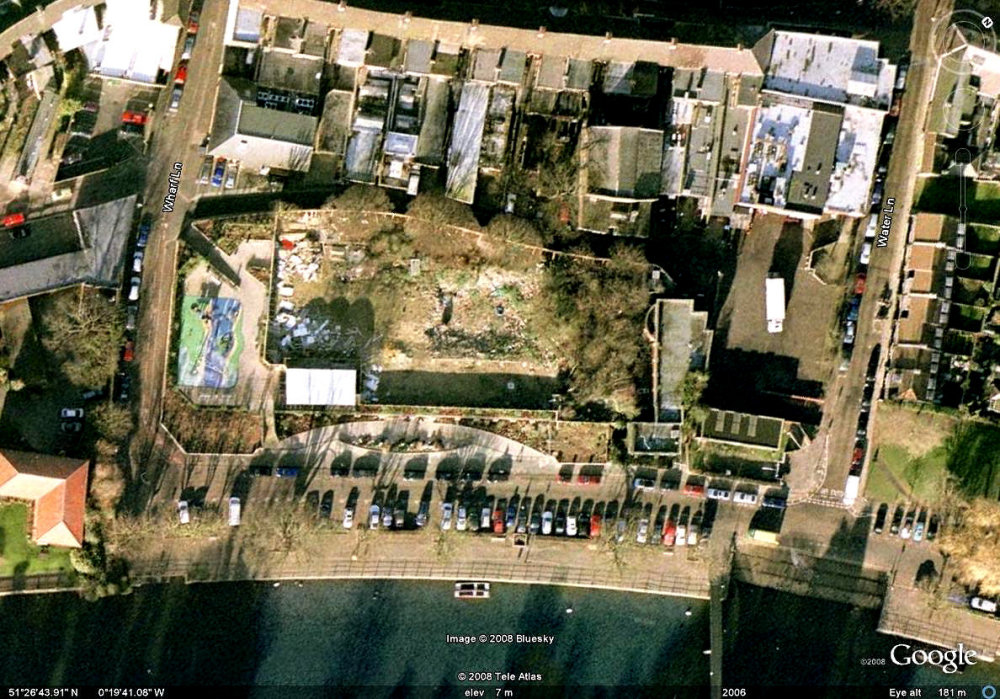
Photograph courtesy of Google Earth. |
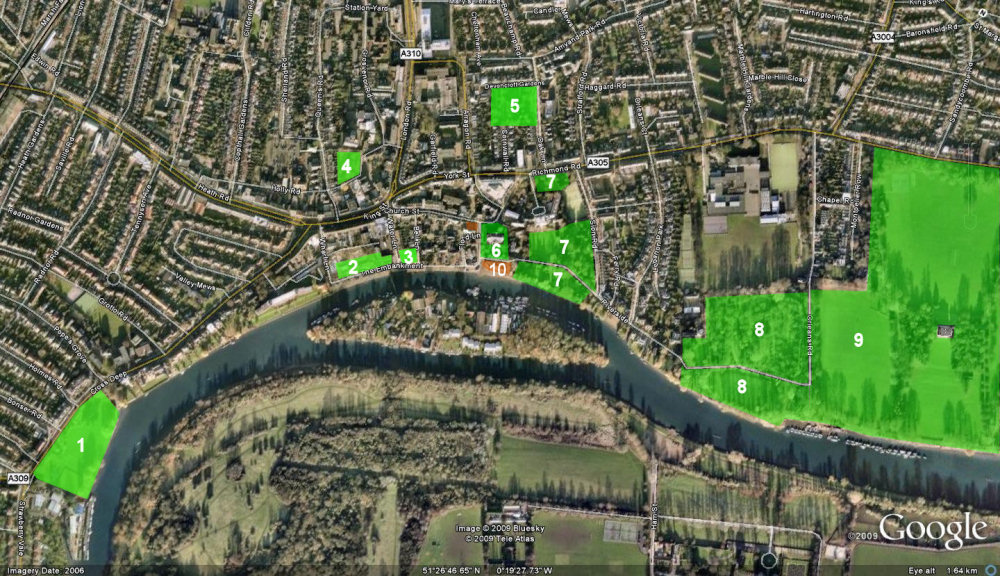
GREEN SPACE IN TWICKENHAM
See below for the index to the numbers
|
The green spaces are:
- Radnor Gardens
- The projected green space on the poolsite redevelopment
- Green space at bottom of Water Lane
- Holly Road park and play area
- Oak Lane cemetery
- St Mary's churchyard
- York House Gardens
- Orleans Gardens
- Marble Hill Park
plus 10. Champion's Wharf - designated Metropolitan open land
|